


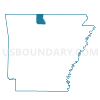
BEARDEN Voting District, Marion County, Arkansas
About
Outline

Summary
| Unique Area Identifier | 527261 |
| Name | BEARDEN Voting District |
| County | Marion County |
| State | Arkansas |
| Area (square miles) | 25.97 |
| Land Area (square miles) | 25.95 |
| Water Area (square miles) | 0.02 |
| % of Land Area | 99.94 |
| % of Water Area | 0.06 |
| Latitude of the Internal Point | 36.17697600 |
| Longtitude of the Internal Point | -92.59318840 |
Maps


Graphs
Select a template below for downloading or customizing gragh for BEARDEN Voting District, Marion County, Arkansas


Neighbors
Neighoring Voting District (by Name) Neighboring Voting District on the Map
- BUFFALO Voting District, Marion County, AR
- CROOKED CREEK Voting District, Marion County, AR
- JEFFERSON Voting District, Marion County, AR
- UNION Voting District, Marion County, AR
- WATER CREEK Voting District, Marion County, AR
- WHITERIVER Voting District, Marion County, AR